

Norway
Rembesdalskåka at Hardangerjøkulen
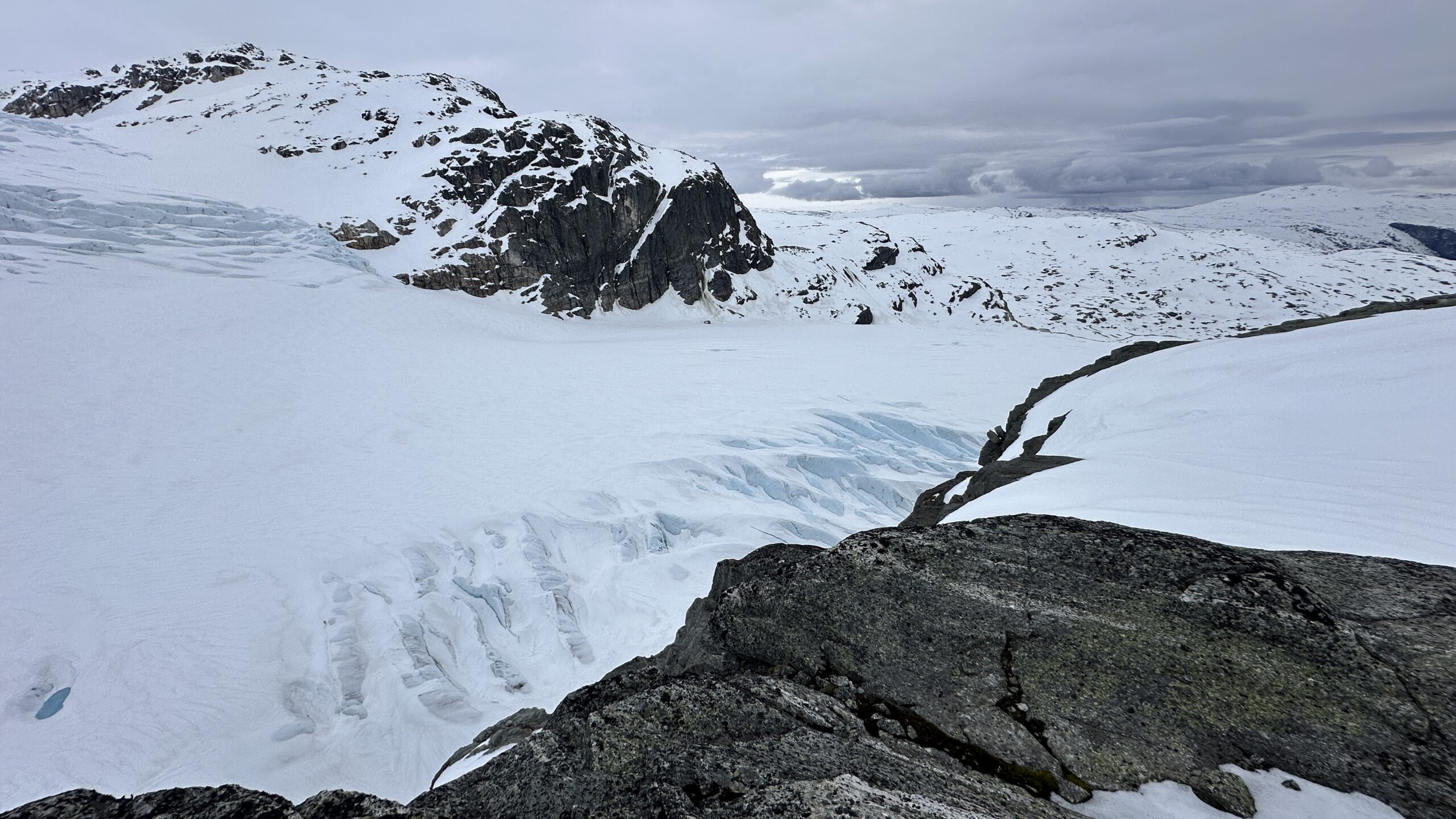
Rembesdalskåka is an outlet glacier of the ice cap Hardangerjøkulen in Southern Norway, and it is reachable with a snow scooter and a short ski tour in spring, or with a long eight-hour hike from Finse train station in summer. We monitor an ice-dammed lake that fills up and empties via the glacier tongue nearly every season. For this, we use water level loggers, time–lapse cameras, a weather station and drones. Weather conditions at this field site can be challenging, and the location is relatively remote for mainland Norway.
Contact
A team of glaciologists from the Norwegian University of Science and Technology (NTNU) have been carrying out field measurements and installations at this field site twice a year since summer 2022 within the pilot project “GOTHECA”. The glacier Rembesdalskåka has been monitored by the Norwegian Water Resources and Energy Directorate (NVE) since 1917, focusing on the glacier length, and since 1963, regarding mass balance measurements. It stretches from 1860 meters above sea level down to 1020 and covers an area of 17 km2. The glacier forms a natural ice dam, blocking a side valley and damming up the Nedre Demmevatnet Lake, which currently fills with 1–2 million cubic meters of water every summer. The lake fills with snow and ice melt water stemming from the Hardangerjøkulen area, and currently it empties in a sudden glacial lake outburst flood (GLOF) event. This occurs every summer between June and August, lasting roughly 6–12 hours.
The glacier tongue of Rembesdalskåka is about 270 meters thick, and the tongue has retreated by 2 km since the late 19th century. All the water from the ice-dammed lake empties into the downstream hydropower Rembesdalsvatnet Lake, which generates power for the Sima power plant managed by Statkraft. Due to the artificial dam, this GLOF lake no longer poses a threat to the downstream population in the Eidfjord Valley, but it used to be a very threatening lake, resulting in devastating outburst floods in the late 19th and early 20th century.
At this site, water level measurements using level loggers and time-lapse cameras are used to study the lake’s filling and emptying processes, as well as to obtain data for model calibration and validation. Automatic weather station data from this field site helps characterise the meteorological conditions prevailing before and during an outburst flood event. Additionally, previous measurement campaigns (involving UAV-based photogrammetry missions) determined the lake bathymetry of this ice-dammed lake.
Existing ground penetrating radar measurements of the glacier tongue, conducted by the team from NTNU, provide estimates of ice thickness, and it is expected that future radar measurements could also give indications about the presence of subglacial channels. The main challenge remains the measurement of water level and discharge at the glacier outlet during an outburst flood. This is a very challenging task due to the high discharge, as the sensors can be carried away.
There is a webcam installed at this site that allows permanent monitoring of the lake level and glacier. The meteorological station is usually set up just for the summer months due to the harsh weather conditions. It is located close to the oldest Norwegian Tourism Association (DNT) Mountain Hut. Helicopters have not been utilised in the measurement or monitoring of this ice-dammed lake to date.
Blogs
Monitoring the Cryosphere’s Movement in the Rembesdalskåka Glacier
Our field trip to Rembesdalskåka at Hardangerjøkulen ice cap in southern Norway was completed by a team of three: Pascal Egli (Associate Professor at NTNU), Ursula Enzenhofer (PhD… Continue reading Monitoring the Cryosphere’s Movement in the Rembesdalskåka Glacier


