

Svalbard (Norway)
Scott Turnerbreen Forefield Observatory
The Scott Turnerbreen Forefield Observatory is a site situated in Svalbard, Norway, that monitors permafrost and glacier interactions. Given the rapid retreat of Svalbard’s glaciers, it is expected that permafrost would aggrade and form a cryospheric cap in their forefields. However, in many cases, nutrient and gas-rich groundwaters establish new discharge routes where the permafrost should be forming, exploiting what should otherwise be a relatively impermeable landscape. CryoSCOPE aims to understand the dynamics of groundwaters in Svalbard’s exposed glacier forefields and assess their contribution to the surface water budget, nutrient export, and methane release.
Contact
Visit request
Express interestThe Scott Turnerbreen Forefield Observatory is situated in Central Spitsbergen, Svalbard, an area underlain by continuous permafrost. Permafrost is often described as a cryospheric cap or an impermeable layer that minimises mixing between surface runoff and groundwater. Scott Turnerbreen (Scott Turner Glacier) is a rapidly retreating cold-based glacier. Its exposed forefield has an active hydrological system that builds proglacial icing in the winter due to outflows of gas-rich groundwaters, implying that permafrost has yet to form a complete cryospheric cap. Understanding how permafrost forms in front of retreating glaciers is essential in the context of climate warming, as the “leakage” of these fluids has consequences for water, nutrient and greenhouse gas budgets. Their discharge through glacier forefields is increasing significantly across Svalbard and potentially along glacier margins throughout the Arctic.
The objectives of this project are to systematically monitor the surface and sub-surface environments of the Scott Turnerbreen Forefield. One of the main goals is to gain new insights into the thermal and physical evolution of the glacier forefield with time since glacier retreat. The second one is to describe the hydrological system that builds proglacial icings with gas-rich groundwaters. The Scott Turnerbreen Site has been selected because of its accessibility from Longyearbyen, located six km from the road end, and its well-documented retreat history.
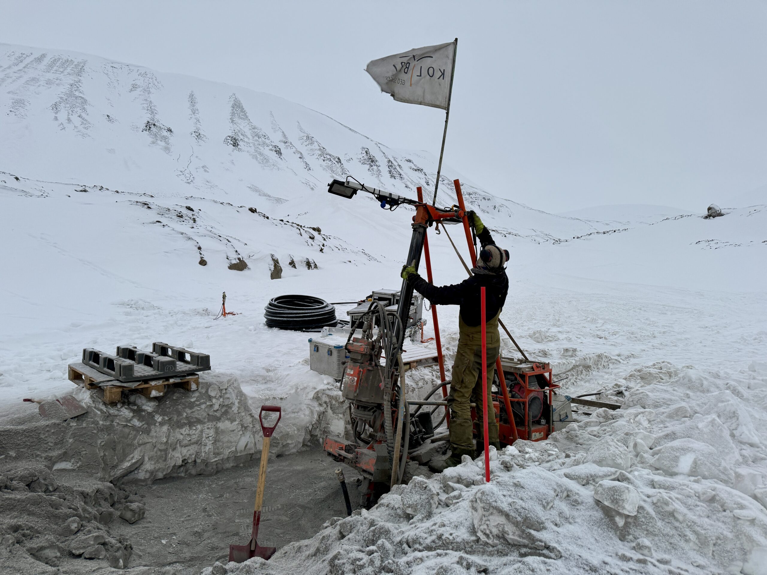
Eight boreholes between 20 and 50 meters deep were drilled at different locations in the forefield and instrumented with thermistor strings to monitor the ground thermal regime in the forefield and to determine areas of permafrost aggradation. These thermal measurements are paired with geophysical surveys (electrical resistivity tomography, cross-borehole ground penetrating radar and induced polarisation imaging and transient electromagnetics) to further characterise the physical state of the ground and potential hydraulic flow paths.
A meteorological station has been deployed at the site, along with glacier stakes and a time-lapse camera, to estimate surface energy and water budgets. Snow surveys are conducted during the spring (March-May), stake surveys are undertaken in September, and a river gauging station is deployed during the melt season (June-September) to further monitor the surface hydrology of the site. Discharge measurements and geochemical water sampling of both surface water and groundwater are done weekly during the melt season to understand seasonal dynamics at the site.


